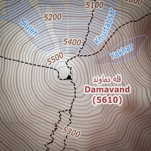
21 May 2016 |
I present a tourist map of Damavand, Iran!
1:30 000/1:100 000 scale, GPS grid, hillshading, tinting, most popular routes. Everything ready for printing on A3 sheet.
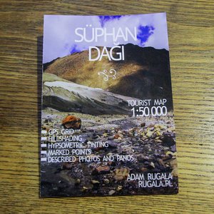
17 March 2015 |
Next hand-made map! This time it's the second highest peak in Turkey - Süphan Dağı (4058 m AMSL).
1:50 000 scale, GPS grid, hillshading, tinting, photos and panos described. As always, everything is ready for printing on A3 sheet.
18 February 2015 |
I present the first tourist map of Aragats, Armenia!
1:25 000 scale, GPS grid, hillshading, tinting, suggested routes and points of interest described. Everything is ready for printing on A3 sheet.
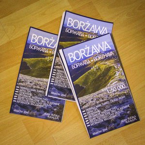
25 March 2014 |
I present the first, hand-made tourist map of Borzhava, Ukraine!
1:50 000 scale, GPS grid, hillshading, tinting.